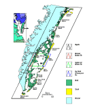
 Figure 1. The Virginia Coast Reserve LTER. The site is 110 km long and 25 km wide. The four research sites referred to in the proposal are indicated by boxes and identified in the legend.
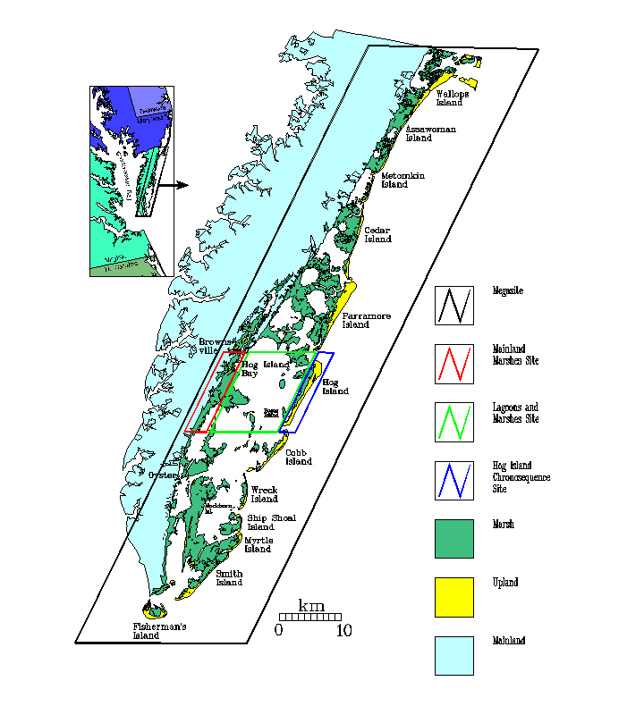
Figure 1. The Virginia Coast Reserve LTER. The site is 110 km long and 25 km wide. The four research sites referred to in the proposal are indicated by boxes and identified in the legend.
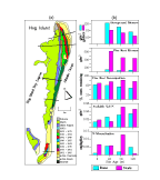 Figure 2. Landscape element ages of Hog Island as determined from historical maps, aerial photos, and geomorphological surveys. The five vegetation-study transects shown have been occupied since 1988. The panel at the right shows biomass for grasses (g/m2)and myrica (g/shoot), decomposition, and nutrient conditions for dune and swale landscape units of various ages.
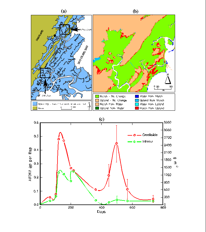
 Figure 3. The Mainland Marsh Site (3a). Phillips Creek is the location of long term monitoring and Mill Creek is the site our long-term inundation experiments. Panel 3b shows the landscape changes over the last 50 years in the Phillips Creek area. Panel 3c. Spartina alterniflora root production in creekside and mid-marsh sediments. Error bars are 1 SD (n=3) except where SD is less than the size of the symbol.
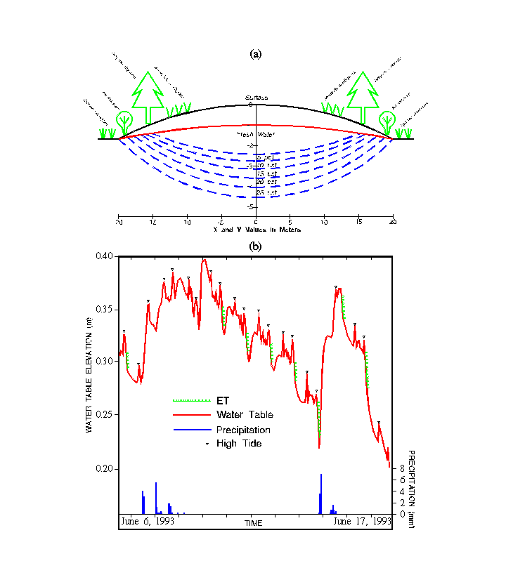
 Figure 4. Water table and sub-surface salinity of a "Parramore Pimple"(4a). Variations of water table elevation within a "pimple." Green shading on the curve indicates water table elevation reductions due to evapotranspiration. Twice-daily peaks in the water table elevation due to the semi-diurnal tides are also indicated.
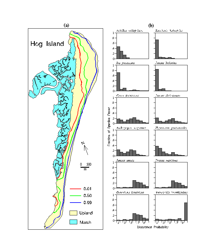
 Figure 5. (5a) Probabilities of vegetation burial by beach sands for Hog Island. Probabilities are calculated from measurements taken from aerial photographs (1949-1990). (5b) Fractional cover for twelve common species were obtained from a vegetation map (McCaffrey and Dueser, 1990). Information for 88 additional species is also available.
 Figure 6. Changes in the Virginia barrier island complex since 1700, based on early sketch and survey maps of the Virginia barrier islands from 1700 to 1924. Detailed survey-quality mapping began in the 1850s and aerial photography based mapping in the 1930s.
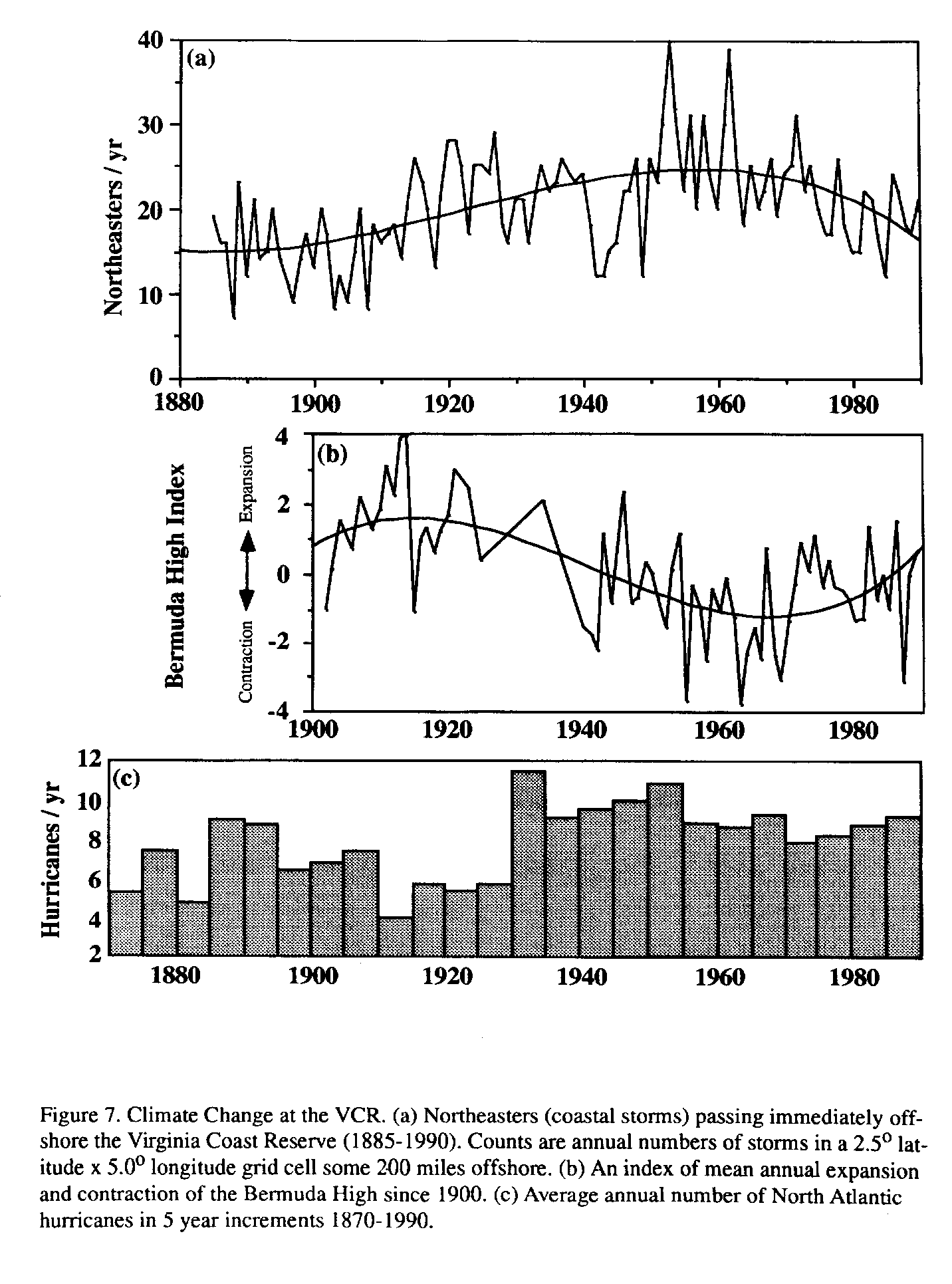
 Figure 7. Climate Change at the VCR. (a) Northeasters (coastal storms) passing immediately offshore the Virginia Coast Reserve (1885-1990). Counts are annual numbers of storms in a 2.5o latitude x 5.0o longitude grid cell some 200 miles offshore. (b) An index of mean annual expansion and contraction of the Bermuda High since 1900. (c) Average annual number of North Atlantic hurricanes in 5 year increments 1870-1990.
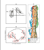 Figure 8. Ecosystem state change. (a) Schematic illustrating the difference between state change and succession (after Hayden et al. 1991). The axes in the phase diagram are a multivariate representation of ecosystem state variables. (b) An example of state change in a phase diagram of phytoplankton communities defined using principal components (after Allen et al. 1977). Numbers the order in which quasi-equilibrium state occurred over the year. (c) State changes (high marsh to low marsh and shrubs to high marsh) and successional change (grassland to shrubs) on North Hog Island (1974-1989)
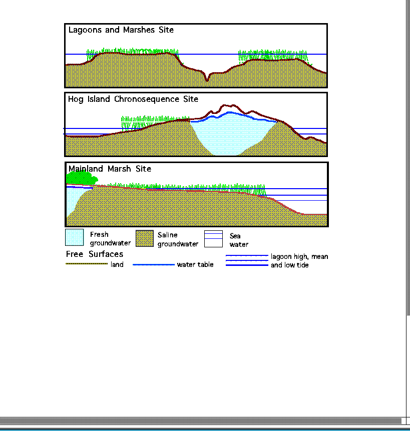
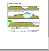 Figure 9. Characteristic configurations of land, water-table, and lagoon-water free surfaces at the Lagoons and Marshes, Hog Island Chronosequence and Mainland Marsh Sites.
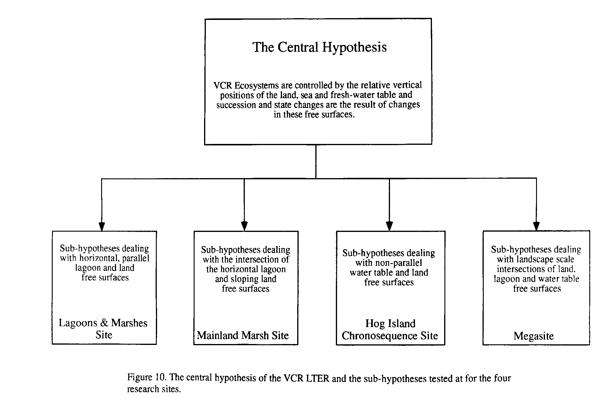
 Figure 10. The central hypothesis of the VCR LTER and the sub-hypotheses tested at for the four research sites.
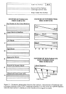 Figure 11. Geometric relationships between free surfaces of characteristic of landscape and ecosystem elements. Landscape elements A-G may occur as a spatial sequence when the land surface is sloping as in the transition from lagoon to marsh.
 Figure 12.
 Figure 13. Biogeography of small mammals on the Megasite. (a) Distribution of small mammal species on the Virginia barrier islands. Some species (e.g., Oryzomys palustris) are ubiquitous, whereas some species (e.g., Cryptotis parva) are restricted to the largest islands. (b) Island faunas are dynamic, with several apparent extinctions of species from islands. (c) The genetic interrelationships of island and mainland populations of are being analyzed using electrophoresis. (d) On Hog Island the abundances of the two most common species vary widely. The "Halloween Storm" of 1991 had no consistent effect on small mammal populations.
 Figure 14. The North Hog Chronosequence Site. (14a) The topography, ages, and characteristic vegetation cover of the North Hog Chronosequence Site. The map (14b) shows the current pattern of landscape/ecosystem units at the site and the black triangles indicate the locations for the dates given in 14a.
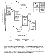 Figure 15. Conceptual model showing sequences of ecosystem state changes that occur on the Virginia barrier islands. The left axis of the diagram indicates the elevations of the land, sea, and fresh water-table surfaces. The horizontal axis indicates the time spans over which sequences of state changes occur and the frequency of disturbance typical of each state. State changes from left to right are typical of landscapes subject to erosion from coastal storms and state changes from the right to left arrows are typical of accretionary, land building processes.
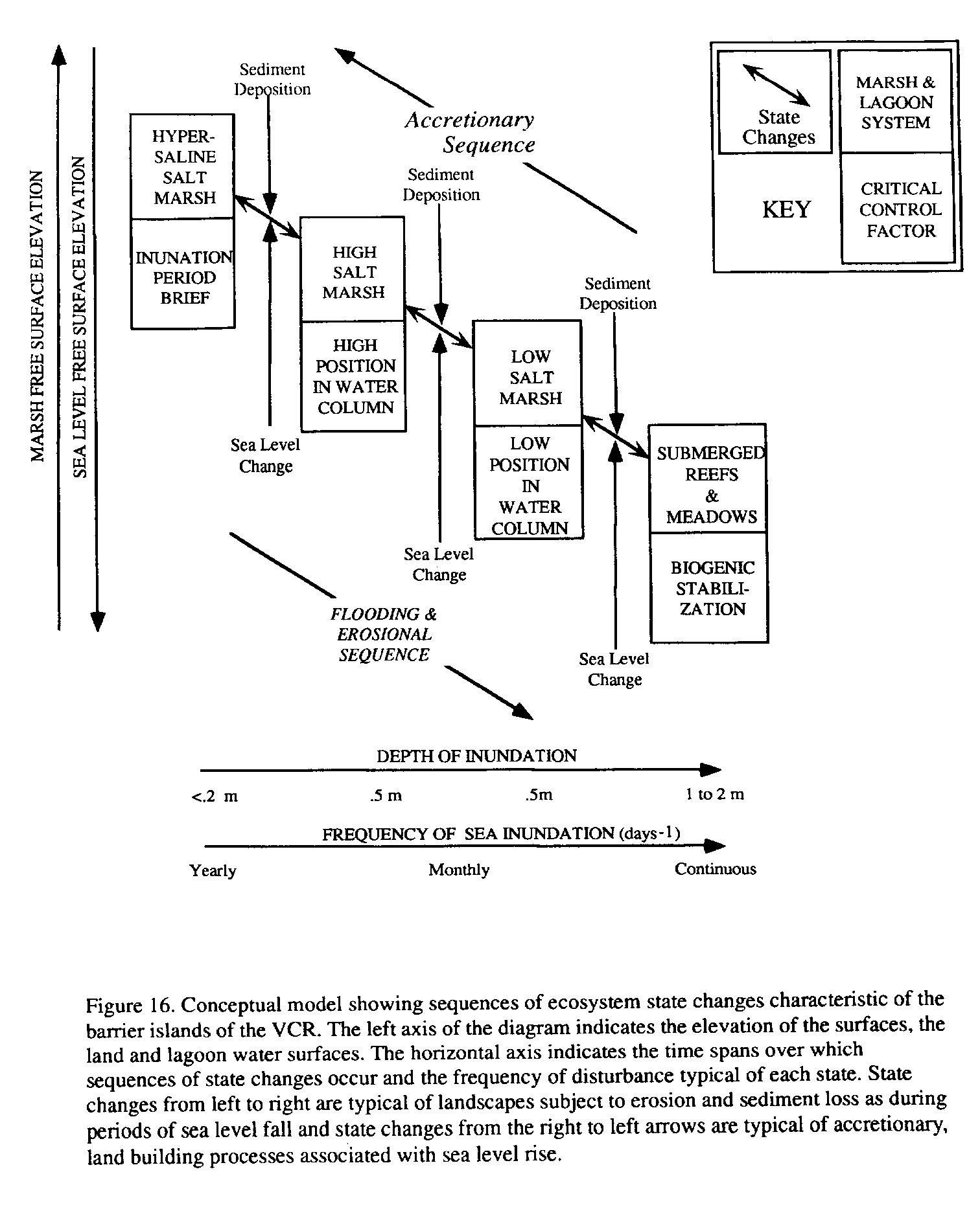
 Figure 16. Conceptual model showing sequences of ecosystem state changes characteristic of the barrier islands of the VCR. The left axis of the diagram indicates the elevation of the surfaces, the land and lagoon water surfaces. The horizontal axis indicates the time spans over which sequences of state changes occur and the frequency of disturbance typical of each state. State changes from left to right are typical of landscapes subject to erosion and sediment loss as during periods of sea level fall and state changes from the right to left arrows are typical of accretionary, land building processes associated with sea level rise.
 Figure 17. Conceptual model showing sequences of ecosystem state changes characteristic of the mainland marshes of the VCR. The left axis of the diagram indicates the elevation of the surfaces, the land and lagoon surfaces. The horizontal axis indicates the time spans over which sequences of state changes occur and the frequency of disturbance typical of each state. State changes from left to right are typical of landscapes subject to disturbance and long-term increases in the frequency of inundation due to sea-level rise.
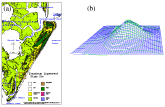 Figure 18. The drawdown experiment. (a) Location of drawdown experiment on Parramore Island. The land-cover map was produced using a 1992 Thematic Mapper image. (b) Exaggerated topographic view of the dune where the pumping well is located as seen from the North at 75-m distance 30-m elevation. Mesh squares are 1 m on a side and green topographic contours are at 10 cm intervals.
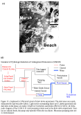 Figure 18. (continued) (c) Physical layout of drawdown experiment. The dark areas are marsh, dominated by Spartina alterniflora. Light circles surrounding dunes are S. patens grassland and dark dots on the dunes are cedar (Juniperus virginiana) and shrubs (Myrica cerifera).
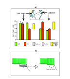 Figure 19. (a) Spartina alterniflora stem heights marsh lowering experimental sites. Treatment plots were lowered 15 cm. Lowering the marsh surface resulted in increased stem growth. (b) Schematic of the marsh lowering experiment.
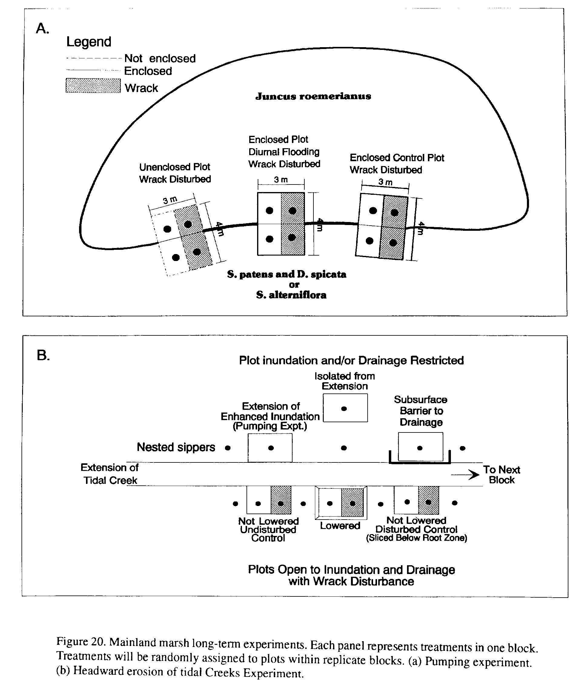
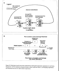 Figure 20. Mainland marsh long-term experiments. Each panel represents treatments in one block. Treatments will be randomly assigned to plots within replicate blocks. (a) Pumping experiment. (b) Headward erosion of tidal Creeks Experiment.
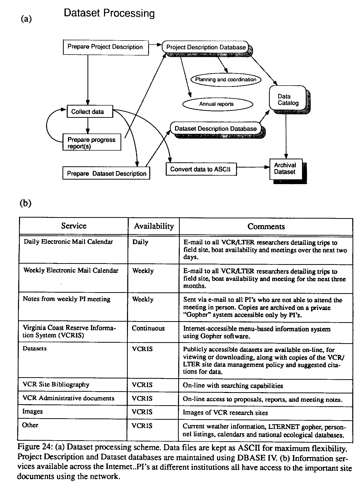
 Figure 24. Data Mgt.
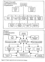 Figure 25. Project organization and communication linkages.