| Regionalization at the AND |
|
Authors: Mark E. Harmon
Scientific Basis for Regionalization at the AND LTER Site
| Regionalization at the AND |
|
|
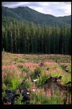
The H.J. Andrews Experimental Forest, home of the H. J. Andrews LTER, is located in the Cascade Range and the Douglas-fir dominated coniferous forests of the Pacific Northwest (PNW). The H. J. Andrews Experimental Forest was established in 1948, became an International Biosphere Program site in 1970, and became an NSF Long Term Ecological Research site (LTER) in 1980. Research at this LTER focuses on all aspects of forests and mountain streams.
The theme of H. J. Andrews LTER ecosystem research is to understand and contrast the effects of land use (principally forest cutting and roads), natural disturbances (principally wildfire and geomorphic processes), and climate change on key ecosystem properties including: hydrology, carbon and nitrogen cycling, biological diversity, albedo, trace gas exchange, and site productivity. Our past efforts have emphasized this theme at the scale of the 6400 ha H. J. Andrews landscape . During the last 5 years we have realized that many of these topics are better addressed at larger spatial scales, and much of the current research examines these properties in a hierarchical manner up to the region represented by the area in Oregon and Washington west of the Cascade Range crest.
Key features that distinguish our region from that of other LTER sites are:
1) an abundance of winter precipitation and an extended summer drought,
2) dominance by long-lived and extremely large-sized conifers, 3) a high
level of forest productivity, 4) successional seres extending 1000 years
or
more, 5) a natural disturbance regime dominated by fires with return intervals
of 100 to 500 years, and 6) a recent period of land-use development that
has
modified the severity, size, spatial arrangement, and frequency of disturbances.
These characteritics have led our group to focus more on the landscape pattern
of
disturbances and changes in ecosystem properties over succession than is
typical
of many other LTER sites.
Our Overall Approach to Regionalization
Our regional studies have differing objectives. Some efforts aim to define areas sharing common attributes to evaluate the representativeness of the H. J. Andrews site for increasingly larger areas. An example would be the comparison of the H. J. Andrews meterological stations to National Weather Service defined Climate Divisions. Other efforts aim to identify interactions among phenomena at the Andrews and wider geographic areas, including those occurring in landscape patchworks, such as those factors affecting the spotted owl (Strix occidentalis), as well as in stream networks, such as those affecting salmon (Oncorhynchus spp.). The overall objective of these latter efforts (see below) is to use process-based knowledge from point sampling in combination with data on environmental and disturbance gradients to derive predictions of ecosystem function in unsampled areas within our region.
At the Andrews LTER, we are pursuing regional studies using a nested series of areas delimited in terms of watershed boundaries, physiographic provinces, vegetation types, and functional links. We have taken this approach because there is no best spatial extent or temporal scale for a region; rather these parameters must be referenced to the system and processes being investigated (O'Neill, 1988; Wiens, 1989; Levin, 1992). Therefore the Andrews "region" can be viewed from smallest to largest as:
1) The central Cascades subregion, (1400 km2) an area of predominantly forest land in a mixture of Federal and private ownership where many studies centered on the Andrews are in progress,
2) The McKenzie River basin (3500 km2) an important municipal water supply in a largely-forested landscape,
3) The Willamette River system (29,000 km2) which includes major metropolitan centers and areas extensive agriculture,
4) The range of the northern spotted owl (230,000 km2) in the western halves of Oregon and Washington and northwestern California. This species has strong biological similarities to many species inhabiting old-growth ecosystems, and therefore is representive of a widely applied conservation strategy.
5) The Columbia River basin (670,000 km2), a major North American drainage basin encompassing a mixture of forest, shrub-steppe, alpine, desert, and agricultural cover as well as the breeding habitat for anadromous fish species including salmon (Oncorhynchus spp.),
6) The moist temperate conifer biome (380,000 km2), the coastal strip extending from California to Alaska, dominated by needle-leaved, evergreen closed canopy forests.
7) The PNW-North Pacific Ocean Bioclimatic region (5,100,000 km2) which encompasses the major land-ocean interactions of our site. It is estimated that 95% of the climate of PNW is derived from the North Pacific Ocean. Climate conditions in Andrews strongly reflect northeast Pacific circulation patterns at the time scales of years to more than a decade. It is also an important area for many of the anadromous fish species that link freshwater and marine environments.
The H. J. Andrews Experimental Forest was established in 1948 on US Forest Service land in natural conifer, mainly old-growth (>400 yrs) forest initiated after severe wildfires. Forests in the Andrews are broadly representive of the Tsuga heterophylla and subalpine (Abies spp.) forest zones that stretch along the Cascades, Klamath, and Coastal mountains from Canada into northern California. Currently the Andrews has a higher proportion of old-growth, mid-elevation forests than most surrounding areas. Old-growth forests at the Andrews are representative of the best habitat for spotted owl in the Pacific Northwest, and have an unusually high diversity of canopy and soil arthropods. Like the Cascade Range, the Andrews is predominantly volcanic, but its volcanic rocks are older and more highly weathered than those of the high Cascades to the east, and it lacks the sedimentary and metamorphic rocks characteristic of the Klamath and Coastal mountains. Topographic relief in the Andrews is high, with slopes up to 100%, broadly representative of the Cascades to the north and south, but steeper than the high Cascades to the east and the Willamette Valley to the west, and with much longer slopes than typical of the Coast Ranges. The climate of the Andrews is Mediterranean, and generally representative of the Pacific Northwest region, but with higher precipitation and lower temperatures than lower elevations/lower latitudes, and lower precipitation than higher elevations/higher latitudes. Spanning an elevation range of 400 to 1630 m, the Andrews includes elevation zones representative of the rain-dominated, rain-on-snow, and snow-dominated portions of Pacific Northwest mountain ranges, but the concentration of elevations in the 400 to 1200 m zone means that the hydrologic system is primarily rain-on-snow dominated. Lookout Creek in the Andrews is a fifth-order stream, containing arthropod, amphibian, and some fish species, but lacking the salmonids of larger rivers and coastal streams. The Andrews is located upstream of major dams that regulate streamflow in most of the Pacific Northwest, and lacks land-uses representative of wilderness, Federal general forest, private forest lands, agricultural lands, and urban areas.
Specific Examples of Scaling to the Regional Level
Data for our regional studies are of two types: point data and area data. Point data from plots are our principal source of information about ecological and geophysical processes. Area data are from secondary sources, such as remote sensing and compiled maps that depict regional patterns of species or life-form abundance, forest condition, disturbance, climate, geology, and soils. In some of our regionalization efforts point data are used directly for spatial interpolation of patterns (see below). The density of data for most of our primary study plots, however, is not amenable to direct spatial interpolation. Therefore in most studies, we use primary study plots to establish relationships with key variables and processes and then utilize secondary data describing the patterns of these variables to produce spatial extrapolations at the regional scale. This extrapolation may be performed using statistical models or simulation models depending on the specific study.
Regional studies that are ongoing within the H. J. Andrews LTER or with key scientific collaborators are presented below ranging from point data in which regional gradients are being examined to studies which combine point and area data to make regional estimates.
1) A LTER supported network of long-term vegetation plots is distributed through the Pacific Northwest, and provides 10 to 80 year records of forest development in a chronosequence of stands representing various forest types. Data gathered from this network is bing used to examine how spatial and temporal gradients control population, community, and ecosystem processes in forests.
2) Soil processes are being examined for regional gradients in three sets of studies that cover the Oregon Cascade and Coast Ranges. A key aspect of this work is to examine how variation in soil processes and properties vary with spatial scale.
3) Paleoecological studies are being conducted in the Pacific Northwest with the objective of examining changes in species abundance and fire disturbance over the last 20,000 years.
(4) Hydrologic effects of logging and road construction are being studied in a series of 6 large (60-600 km2) basins and 15 small (<2.5 km2) watersheds in the central Cascades of Oregon,
5) Fire history is currently being studied in the central Cascades, central Coast Range, and south Umpqua basin. These current efforts are being linked to past work by a compilation of dendrochronology-based studies along the Cascades of Oregon and Washington thus providing a regional view of gradients in fire regimes,
6) The U.S. Forest Service's Forest Inventory network of approximately 10,000 field plots is being used in mapping distributions of woody plant communities across Oregon, and in a multivariate analysis of environmental an disturbance factors explaining variation in community composition,
7) Studies of land ownership and land-use relations in the central Coast Range and Cascades of western Oregon using historical satellite imagery and aerial photography to determine forest condition (age class and hardwood versus conifer composition),
8) A combination of remote sensing and ecological simulation modeling is being used to estimate changes in carbon stores between 1972 and 1995 in the the western halves of Oregon and Washington. This study is augmented by a regional compilation of information on soil carbon, forest site productivity, and elements of land use history pre-dating the remote sensing record, and
There are several directions our LTER anticipates moving in the next 5 years. First, we would like to perform a formal analysis of the "representiveness" of the H. J. Andrews to the surrounding area (similar to the efforts at the Short Grass Steppe LTER). Second, we would like to more dynamically model disturbances (natural and human-induced) at the landscape and regional scales. Finally, we would like to incorporate an assessment of the social implications of modifying the land-use, natural disturbances, and climate in our region.
David Greenland (dgreenland@lternet.edu)
Mark Harmon
(mharmon@lternet.edu)
Art McKee
(amckee@lternet.edu)
Fred
Swanson (fswanson@lternet.edu)
Levin, S. 1992. The problem of pattern and scale in ecology. Ecology 63(6): 1943-1967.
O'Neill, R.V. 1988. Hierarchy theory and global change. pp. 29-46 In Scales and global change: Spatial and temporal variability in biosphereic and geospheric processes. Eds. T. Rosswall, R.g. Woodmansee, and P.G. Risser. SCOPE 35, John Wiley, Chichester, New York. 355 pp.
Wiens, J.A. 1989. Spatial scaling in ecology. Functional Ecology 3:385-397.


 Click
on one of the following to go directly to a research area:
Click
on one of the following to go directly to a research area: