| Regionalization at the JRN |
|
Authors: James F. Reynolds and Ross A. Virginia
Scientific Basis for Regionalization at the JRN LTER Site
| Regionalization at the JRN |
|
|
REGIONAL DESCRIPTION
Similar changes in vegetation and soils have occurred over large areas of the Chihuahuan desert and in other areas of the world, where semiarid grasslands have been replaced by shrubland vegetation. The Jornada Basin is a designated Man and the Biosphere (MAB) Reserve, which allows comparative studies at other MAB Reserves in the Chihuahuan Desert at Big Bend National Park (Texas) and the Mapimi Biosphere Reserve in Mexico. In addition, we believe that studies at the Jornada LTER program can be used to infer the causes and consequences of desertification worldwide.
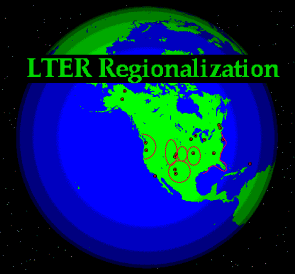
Field research at the Jornada LTER is conducted in various habitat types found within New Mexico State University's Chihuahuan Desert Rangeland Research Center (25,900 ha) and the adjacent lands of the USDA Jornada Experimental Range (78,266 ha). These lands, which form the Jornada del Muerto Basin in southern New Mexico, are found at the northern end of the Chihuahuan desert, which extends from south central New Mexico, USA to the state of Zacatecas, Mexico, comprising 36% of North American Desert land (MacMahon and Wagner l985) (see JRN Figure 1).
Vegetation varies along the north-south axis of the Chihuahuan desert, and the habitat types studied at the Jornada are most representative of the northern, Trans-Pecos subdivision of this region. The Jornada LTER focuses on 5 habitat types: black grama grassland (Bouteloua eriopoda), creosotebush scrub (Larrea tridentata), mesquite duneland (Prosopis glandulosa), tarbush shrublands (Flourensia cernua) and playa (see JRN Figure 2). The playas, dominated by a variety of grasses, are found in low- lying, periodically flooded areas that receive drainage waters from the various upslope communities.
The climate of the northern Chihuahuan desert is characterized by abundant sunshine, wide diurnal ranges of temperature, low relative humidity, and extremely variable precipitation. The average maximum temperature of 36 C is usually recorded in June; during January the average maximum temperature is l3 C. Precipitation averages 23 cm annually, with 52% typically occurring in brief, local, but intense, convective thundershowers during July to September. Winter precipitation during synoptic weather patterns that derive from the Pacific Ocean is more variable than summer precipitation, but it is more effective in wetting the soil profile.
The Jornada lies within the Basin and Range physiographic province, in which parallel north-south mountain ranges are separated by broad valleys filled with alluvial materials. This Basin and Range topography extends westward through Arizona and Nevada to the Mojave Desert of California. Throughout this region, soil development is strongly determined by topographic position, parent material, and climatic fluctuations during the Quaternary (Gile et al. l98l). Pleistocene-age alluvial materials form Aridisols with highly developed calcic/petrocalcic horizons, known as caliche, while Holocene alluvium is often poorly differentiated.
Topographic position, soil development, and human impact interact to determine vegetation dynamics in the northern Chihuahuan desert, where dramatic changes in vegetation have been observed during the last l00 years (Buffington and Herbel l965). Large areas of former black grama grassland have been replaced by shrubland communities dominated by creosotebush, mesquite and tarbush. It is unclear how over-grazing, climatic change, fire suppression, or rising concentrations of atmospheric CO2 have acted solely or in concert to lead to these changes in vegetation. Although the shrubland communities show lower plant species diversity than the original grasslands, studies at the Jornada LTER show little change in the absolute level of net primary production as a result of these changes in vegetation.
Our attempts to regionalize information and results from the Jornada LTER via experimentation and modeling fall into three general categories: (1) studies within the Jornada Basin; (2) extrapolations and comparisons to other sites within the Chihuahuan Desert (e.g., Sevilleta LTER, Mexico, and Texas); and (3) other arid regions in the U.S. and several other countries including Argentina, South Africa, and Australia.
Examples of these efforts are outlined below:
•Scaling patch dynamics to landscapes to regions. One of the long-term objectives of the Jornada LTER is to use models to develop a synthetic understanding of the interacting processes that lead to desertification and the subsequent changes in ecosystem properties. Three scales of organization are being considered: (1) processes that occur at specific patches or locations; (2) transport of energy and materials between patches; and (3) interfacing local and transport processes into a landscape and regional framework (Reynolds et al. 1996). Our regional scale modeling combines Markov models with cellular automaton models. A Markov process is the traditional model for vegetation dynamics over time without reference to spatial configuration of the system. A cellular automaton is an approach that explores how simple rules of local patch processes can generate complex landscape behaviors in space and time. The hybrid Markov-cellular automaton model (M-CA) simulates ecosystem dynamics as a spatially and temporally discrete system. Temporal dynamics are controlled by the transition probabilities among these states, whereas spatial dynamics are controlled by local rules determined either by neighborhood configuration (i.e., a cellular automaton) or by its association with the transition probabilities. A major advantage of the M-CA approach is that GIS and remote sensing data may be efficiently incorporated because the model can be built with a time series of GIS data and run with initial conditions defined by GIS data. Our integrative M-CA approach is one of the first examples of modeling complex ecosystem dynamics at the landscape scale (Li and Reynolds 1997).
•Rangeland Carbon Balance Study: ARS scientists have established a network of 10 sites (including the Jornada) where rates of exchange of CO2 and water vapor between the atmosphere and the soil/vegetation of grasslands are measures. The study was designed to measure CO2 fluxes from hourly to annual temporal scales, identify influences on net carbon fluxes, and examine influences of management practices on carbon budgets. The Bowen ratio/energy balance approach is employed. Ancillary data include NPP, leaf area, C and N of soil and vegetation, and other soil chemical and physical properties. The network includes sites in the northern cool season grasslands, the prairie grasslands as well as the desert grasslands.
•Quantifying rangeland vegetation-atmospheric interactions. ARS scientists are modeling the hydrologic budget and plant responses to changes in components of the water and energy balance. The area being examined is a 5000 hectare region that includes desert grassland as well as desertified mesquite duneland. Spatially distributed surface energy balance estimates (both Bowen ratio and Eddy correlation approaches) and state variables derived from remotely sensed data types are combined with vegetation measures from ground, fixed wing, and satellite based sensors to input hydrologic models. The study was initiated in 1995.
•Comparative watershed hydrology. Comparisons between the hydrology (especially at the hillslope or patch mosaic scale) of Jornada and Walnut Gulch, Arizona, are in progress. We have conducted extensive hydrology studies (e.g., infiltration, runoff, sediment transport, etc.) at Walnut Gulch and have initiated similar studies on the Jornada. To date, we have mapped two small Jornada watersheds at the shrub scale in order to produce contour maps needed to develop a flow routing algorithm that will work in a finite difference scheme. We have automated water level recorders and sediment samplers at both sites.
•Wind erosion and dust production. This is arguably one of the most significant impacts of desertification at the global scale. The Jornada Basin hosts one of the five geomet stations established and operated throughout the southwest by the U.S. Geological Survey Desert Winds Project. Each station collects continuous data on the concentration of wind-blown particles and boundary layer meteorological conditions that control wind erosion of soils. In addition, we are participating in a regional study spanning Chihuahuan Desert and Great Basin sites to examine the influence of soil crusts on wind erosion.
•Small mammal effects on soil and vegetation heterogeneity. We are conducting a regional intersite comparative experiment to observe the influence of small mammals (kangaroo rats and rabbits) along a latitude/climatic gradient with field sites located MAB reserve near Mapimi, Chihuahua, Mexico, at the Jornada Basin LTER and at the Sevilleta National Wildlife Refuge (Sevilleta LTER). Identical field experiments in grassland and shrubland communities at each site have been established to test the hypothesis that these small mammals are keystone species that determine community composition and ecosystem function in the Chihuahuan Desert.
•Desert geomorphology and landscapes. A regional study of Chihuahuan Desert soils and their evolution is in progress at Big Bend National Park (Texas), MAB Reserve Mapimi (Mexico), and the Muir Ranch (Lordsburg, NM). We are examining the timing of erosion from the late Quaternary based on soil stratigraphy, to reconstruct patterns of vegetation and climate change from stable isotopes, and an analysis of fossil pollen.
•Regional studies of the spatial patterns of soil nutrients in desert ecosystems. We are elucidating the spatial distribution of soil nutrients across different plant communities in the Jornada Basin and Sevilleta LTER sties and comparing and contrasting these to patterns found in the Mojave and Great Basin deserts and the shortgrass prairie (Schlesinger et al. 1996).
•Comparative grama grass plant-soil interactions. CPER, Sevilleta, and JRN scientists are contrasting species differences and the effects of climate on the plant-soil interactions involving the dominant perennial grass communities of these LTER sites.
•Carbon storage in degraded aridlands. We are investigating changes in vegetation and associated soil carbon pools to define the net carbon balance associated with desertification. Is there a net change in ecosystem carbon storage when perennial grasslands are replaced by shrubs? From measurements of plant productivity, soil carbon, and vegetation distribution, we have reconstructed the carbon budgets for the Jornada Basin prior to the introduction of livestock in 1858. This allows us to examine the effects of grazing and land management on regional carbon storage and the potential for these systems to sequester additional carbon under elevated carbon dioxide concentrations (Connin et al. 1997a,b).
•Human dimensions of global desertification. Ultimately, regional models of arid land dynamics need to be incorporated into socio-economic models for the sustainable management of semi-arid rangelands. Towards this goal, we are using our Jornada models in a comparative modeling study of ecosystem productivity and carrying capacity in semi-arid grassland-shrublands of the Karoo in South Africa; arid rangelands of Australia; and the Monte scrub of Argentina. This project is a funded part of the NSF Center for Integrated Study of the Human Dimensions of Global Change at Carnegie Mellon University. A second aspect of this work is the technical advise the Jornada LTER is providing for a project to describe the shrubland ecosystems of Chihuahuan desert in the state of Chihuahua, Mexico (including description of indicators of ecosystem trends), as part of an integrated study of sustainable use of rangelands in these ecosystems. This project is a collaboration with La Campana Experimental Range (Campo Experimental), Chihuahua, and the Instituto Nacional de Investigaciones Forestales y Agropecuarias (INIFAP), Departamento de Manejo de Pastizales y Forrajes, of Mexico.
Connin, S. L., R. A. Virginia, C. P. Chamberlain, L. F. Huenneke, K. Harrison and W. H. Schlesinger. 1997a. Dynamics of carbon storage in degraded arid land environments: A case study from the Jornada Experimental Range, New Mexico (USA). in V. R. Squires, E. P. Glenn and A. T. Ayoub, editors. Drylands and Global Change in the Twenty-First Century. University of Arizona Press, Tucson, Arizona.
Connin, S. L., R. A. Virginia and C. P. Chamberlain. 1997b. The use of carbon isotope techniques to quantify long-term turnover rates and changes in soil organic matter fractions following arid land shrub expansion. Oecologia In Revision.
Gile, L.H., J.W. Hawley, and R.B. Grossman. l98l. Soils and geomorphology in the Basin and Range area of southern New Mexico--Guidebook to the Desert Project. Memoir 36, N.M. Bureau of Mines and Mineral Resources, Socorro.
Li, H. and J. F. Reynolds. In Press. Modeling effects of spatial pattern, drought, and grazing on rates of rangeland degradation: A combined Markov and cellular automaton approach. Pages 211-230 in D. A. Quattrochi and M. Goodchild, editors. Scaling of Remote Sensing Data for Geographical Information Systems. Lewis Publishers, Chelsea, Mi.
MacMahon, J.A. and F.H. Wagner. l985. The Mojave, Sonoran and Chihuahuan deserts of North America. pp. l05-202. In M. Evenari et al., (eds.). Hot Deserts and Arid Shrublands. Elsevier Scientific Publishers, Amsterdam.
Reynolds, J. F., R. A. Virginia and W. H. Schlesinger. 1996. Defining functional types for models of desertification. Pages 194-214 in T. M. Smith, H. H. Shugart and F. I. Woodward, editors. Plant Functional Types. Cambridge Univ. Press, Cambridge, England.
Schlesinger, W. H., J. A. Raikes, A. E. Hartley and A. F. Cross. 1996. On the spatial pattern of soil nutrients in desert ecosystems. Ecology 77: 364-374.
Schlesinger, W.H., J.F. Reynolds, C.L. Cunningham, L.F. Huenneke, W.M. Jarrell, R.A. Virginia and W.G. Whitford. l990. Biological feedbacks in global desertification. Science 247: l043-l048.